USA Geography Placement Challenge
Reviews
This geography activity excels at making rote memorization engaging through its simple yet rewarding placement mechanic. The gradual color fill of the map provides satisfying progress, while the timer adds replay value without pressure. It is particularly effective for visual learners who benefit from seeing state shapes and positions in context. The lack of penalties for mistakes encourages experimentation, making it ideal for both beginners and those brushing up on their US geography. A solid educational tool that respects the player's pace.
Description
Core Learning Loop
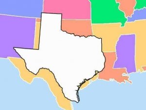
The activity presents a clean outline of the United States with empty spaces marking each state's location. A separate list contains the names of all 50 states plus Washington D.C. Players select a state name and drag it to the correct spot on the map. Correct placements lock the state in place and add color to that region, providing immediate visual feedback. Incorrect attempts return the name to the list, encouraging players to try again without penalty. This cycle of attempt, feedback, and repetition forms the foundation of the learning experience.
Visual Reinforcement System
As states are correctly placed, the map gradually fills with distinct colors, creating a rewarding visual progression. This color-coding helps players associate state shapes and positions with specific regions. The blank map starts as a neutral canvas, and each successful placement transforms it into a vibrant, complete geographic representation. This visual transformation serves as both a progress indicator and a memory aid, reinforcing spatial relationships between neighboring states.
Timed Challenge Mode
A built-in timer tracks the duration from the first placement to the last, allowing players to measure their efficiency over multiple attempts. This element introduces a light competitive aspect, encouraging repeated play to improve completion speed. There are no time limits or penalties for slow performance, so the timer simply serves as a personal benchmark. Players can choose to focus on accuracy first, then work on speed as they become more familiar with state locations.
Accessible Interface Design
The drag-and-drop controls are straightforward and responsive, making the activity suitable for users of all ages and technical skill levels. The interface avoids complex menus or instructions, allowing players to start immediately. The list of state names remains visible throughout, reducing the need for memorization and allowing players to focus on spatial recognition. This simplicity ensures that the activity remains focused on geography learning rather than interface navigation.
Regional Learning Strategies
Players often develop their own approaches to mastering the map. A common strategy involves placing larger, easily recognizable states first, such as Texas or California, and using them as anchor points for surrounding regions. Breaking the country into sections like the Northeast, Southeast, Midwest, and West Coast helps manage the information in smaller chunks. Some players use state shapes as visual cues, while others rely on mnemonic devices to remember tricky placements. The activity supports these varied learning styles by allowing free-form placement in any order.